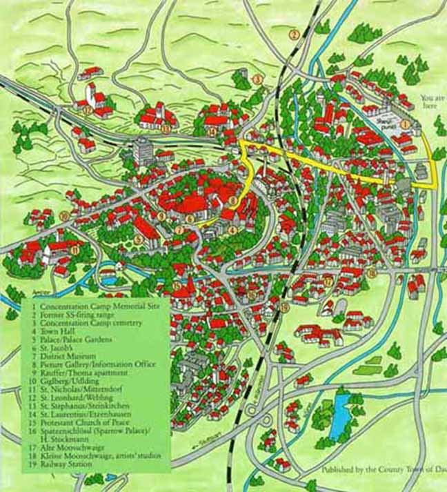
The Memorial Site at the former ConcentrationCamp is # 1 in the upper right hand corner of this map, at Alte-Roemar-Strasse75 in Dachau. The camp is 12 miles northwest of the city of Munichin Upper Bavaria. The row of red-roofed buildings behind the campwalls are the former double villas, which were the residencesof administrative personnel of the factory that was built duringWorld War I where the former Concentration Camp is now located.Therailroad tracks are represented by the black and white line goingfrom top to bottom through the middle of the map, and the railroadstation is #19 approximately in the middle of the map. #2 at thevery top of the map marks the former German SS soldiers' firingrange at Herbertshausen where Russian Prisoners of War were executed.South of the firing range, #3 at the top of the map designatesthe place where the bodies of the prisoners who died prior to,or just after the camp's liberation, were buried, on instructionsof the American Army, by Dachau farmers in a cemetery on Leitenberghill. Others were buried in the town cemetery of Dachau. Before1940 when the camp acquired a two-retort crematory, the prisonerswho died in the Dachau Concentration Camp were buried in massgraves at Leitenberg hill and other cemeteries. This map is onthe back cover of the pamphlet about Dachau , available free atthe Museum.