On the way to Treblinka
 Houses along blacktop
road through Poniatowo, near the Treblinka camp
Houses along blacktop
road through Poniatowo, near the Treblinka camp
From Warsaw, the route to Treblinka starts
with the crossing of the river Vistula, then a turn onto Highway
18 northeast towards Bialystok, the only large town in the Bialystok
province, which is located in the most remote northeast corner
of Poland. It is in the Bialystok province that bison still roam,
and one can see the last remaining primeval forest and wetlands
on the European continent. This area could truly be called the
"Wild East" of Poland.
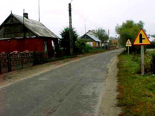
As you can see in the photograph above,
taken in October 1998, the road as it nears the camp becomes
a one-lane blacktop, badly in need of repair. This photo was
taken in a small hamlet which my tour guide identified as Poniatowo.
Treblinka is two kilometers from the
Bug River which, during World War II, formed the border between
the Nazi occupied General Government of Poland and the zone occupied
by the Soviet Union from September 1939 until the German invasion
of the Soviet Union in June 1941. Two other Action Reinhard death
camps, Sobibor and Belzec, were also located very close to the
Bug river which was the border between the General Government
and the Soviet zone of Poland. The Soviet zone was the territory
that had formerly belonged to Russia between 1772 and 1918. Known
as the "Pale of Settlement" between 1835 and 1917,
this was the area where all Russian Jews were forced to live
until after they were liberated by the Communist Revolution in
1917. Treblinka was located on the railroad line running from
Ostrów Mazowiecki to Siedlce; at Malkinia junction, this
line intersected the major railway line which ran from Warsaw
to Bialystok.
Highway 18 is a two-lane concrete road
with pedestrian paths on each side. There is heavy traffic of
trucks from Belarus (Byelorussia or White Russia) and Estonia
traveling west into Poland; traffic is slowed down by local Polish
farmers driving wagons pulled by tractors or by a lone horse.
The terrain is completely flat with farm land on each side of
the road but not a fence in sight. Then the road goes through
mile after mile of dense forest. During World War II, these woods
were full of Polish and Jewish partisans, who hid there along
with escaped Russian Prisoners of War, and fought the Nazis by
blowing up bridges and train tracks or placing land mines to
kill columns of German soldiers. If captured, these partisans
were sent to Dachau or Buchenwald or the main camp at Auschwitz.
At a point 22 kilometers from Treblinka,
the route turns southeast off of Highway 18. This new road is
a one-lane blacktop with no space on the sides for pedestrians.
The road gets progressively worse until the final leg of the
journey is pockmarked with pot holes. This road is shown in the
photo at the top of this page.
The Treblinka camp got its name from
the tiny village of Treblinka, which is around 4 kilometers
from the death camp. In 1998 when I visited, the village of Treblinka
was almost deserted and the buildings were far more dilapidated
than in the other nearby villages.
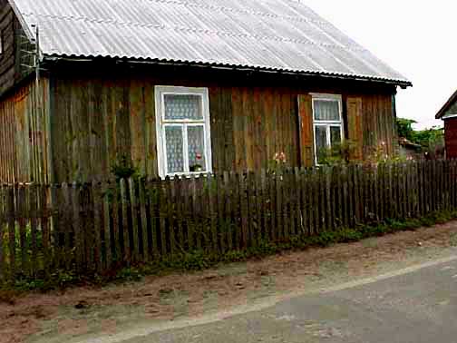 Cottage in Poniatowo,
along the road on the way to Treblinka
Cottage in Poniatowo,
along the road on the way to Treblinka
I was told by my tour guide in 1998 that
the closest houses to the camp were in the tiny hamlet of Poniatowo.
The photo immediately above shows a house which is built of wood
with painted shutters on one window; it is at the edge of the
road with a fence enclosing a small patch of flowers. Some of
these rural dwellings are so humble that you would not suspect
that people still live there if it were not for the lace curtains
which are always hung in the windows of these cottages. Note
the cobblestones along the edge of the road, which you can see
clearly in the photograph above.
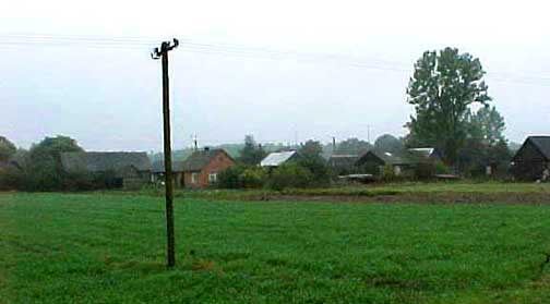 Houses on the way to
the Treblinka camp
Houses on the way to
the Treblinka camp
This page was last updated on November
9, 2008
|