Lower Town in Oradour-sur-Glane
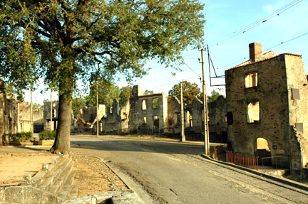
The Lower Town in the ruined village
of Oradour-sur-Glane is the section of the main street that is
at the south end. The church where the women and children were
massacred is behind the camera in the photo above which shows
Rue de Emile Desourteaux as it curves around and climbs up to
the Upper Town at the north end of the village. Les Bordes road
is to the right behind the first building on the right. The town
is on the ridge of a gentle hill. Notice the overhead electrical
wires which get electricity from the tram line that was installed
in 1911.
The photo below shows a view of the outdoor
market place which is to the left of the tree. The church is
on the left, but out of camera range. This market place had a
pitched roof over it which collapsed when the town was destroyed.
The large tree was there before the massacre.
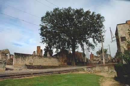
The tree shown in the photo above is
the "Tree of Liberty," planted in 1848 after the revolution
when the Second Republic was established. To the left of the
tree is the remains of the market hall, which was built in 1903.
On the 15th of each month, there was a market day in Oradour-sur-Glane.
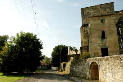
The photo above shows the southern entrance
to the town in the center background. The small building at the
end of the road was the original building where tourists could
buy postcards, maps and brochures about the town. On the right
is the old church and behind it, the presbytery where two priests
and a seminary student lived. All three were killed in the massacre.
This is the road that the SS soldiers
used to enter the town. The opening in the retaining wall in
the right hand corner of the photo above was for a water pump,
since the town had no running water. The church doorway above
this opening is the entrance to the sacistry, where the women
and children tried to find refuge, but SS soldiers standing guard
outside the church fired machine guns into the room.
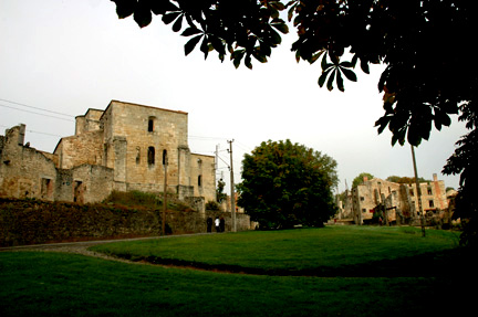
The area across the road from the church
is covered with grass and is labeled as the Market Square on
some maps. This is NOT the place where the villagers were assembled,
although the assembly place is also called the Market Square
by some authors of books about the village.
The photo below shows the grassy area
across from the church which is in the background. The tree in
the foreground is a chestnut tree. The Bouchoule Barn, where
some of the women and children were killed, is to the right and
behind the camera in this view.
|