Gardelegen Memorial Site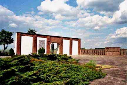 In 1950, the construction and landscaping of a Memorial Site at Gardelegen began in the area near the military cemetery. The barn was torn down, except for part of one wall which was used for the memorial shown in the photo above. What you see in the photo is only half of the front wall of the barn. The length of the barn was twice this long with two doors in the front and two doors in the back. The completed Memorial Site was inaugurated in 1953. It included a line of trees behind the wall, but only two of them were still there in May 2002. The military cemetery is behind the camera and to the left in this photo. The view of the barn from the cemetery is now obstructed by trees planted, in honor of the victims, in the former grain field. 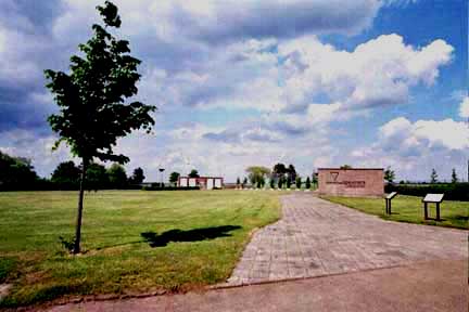 An overall view of the Memorial Site in the photo above shows a wide path leading past a three-sided brick building on the right, then past some memorial stones in honor of the countries from which the prisoners came, finally ending at the remains of the front wall of the barn which has been propped up as a memorial. The documentation center which was created at the Memorial Site in 1991 is directly behind the camera in this photo. 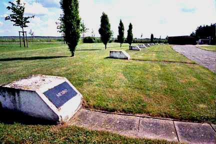 Markers which resemble grave stones line the path from the entrance to the memorial wall. Each stone has the name of one of the countries that the prisoners were from: Belgium, France, Poland, the Soviet Union, Italy, Yugoslavia, Mexico, Holland, Czechoslovakia, and Hungary. The stone in the foreground is in honor of prisoners from Mexico who died in the barn. Two of the stones, which were placed here in 1965, have no inscription on them. The building in the background is the documentation center. The prisoners were resistance fighters and partisans who had been captured while fighting as civilians in World War II. They were being evacuated from the concentration camps before the Allied liberators arrived. These were the prisoners that were considered to be the most dangerous to the German civilian population after they were set free. 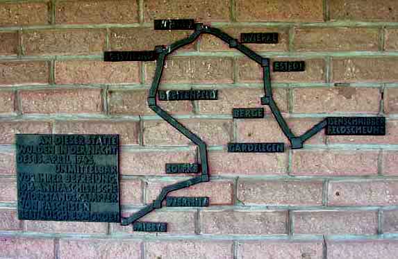 Midway along the path from the entrance, there is a three-sided empty brick building. A map of the route taken by the prisoners, as they were forced to march from their stalled train to Gardelegen is shown on the wall. The village of Solpke is only 10 kilometers from Gardelegen by rail but the prisoners had to take an alternate route on foot because the tracks had been destroyed by the Allied bombing. 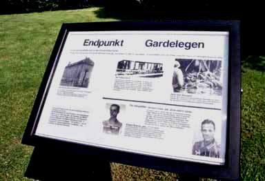 ContinueHome |