The Birkenau Camp
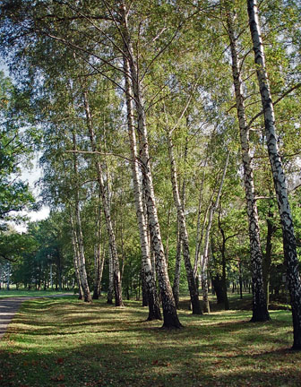 Birch tree grove at
the west end of the Birkenau camp, Oct. 2005
Birch tree grove at
the west end of the Birkenau camp, Oct. 2005
The Birkenau camp was named for the birch
trees that are located on the west side of the camp, as shown
in the photo above.
The Birkenau death camp was located on
a major road, about 3 kilometers from the main Auschwitz camp.
The photo below shows the busy road that goes past the camp.
In the foreground is a one-man air raid shelter. The camp was
in danger of being bombed because of the factories at the Auschwitz
III camp, called Monowitz. Note the guard tower and the barbed
wire fence on the left hand side of the photo. In the background
are new houses that have been built very close to the former
camp.
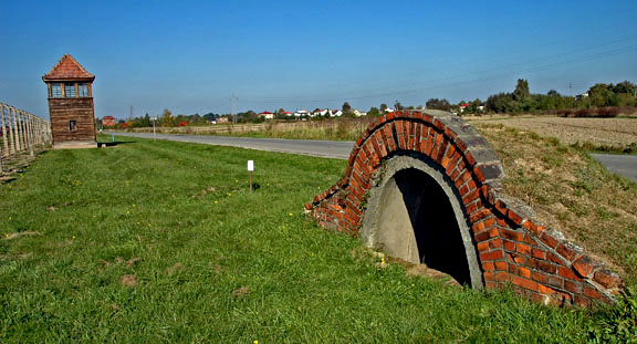 One-man air raid shelter
along the road beside the Birkenau camp, Oct. 2005
One-man air raid shelter
along the road beside the Birkenau camp, Oct. 2005
The road shown in the photo above goes
past the former SS administration building at Birkenau which
is now a Catholic Church and school, as shown in the photo below.
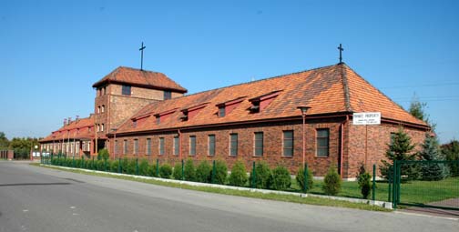
Catholic Church and
school in building formerly used by the SS, Oct. 2005
The photo above shows the SS headquarters,
built in 1944 at Birkenau, which has been converted into a Catholic
church and a school. This building is located about a quarter
of a mile north of the red brick gate house of the Birkenau camp,
which is on this same road, but on the opposite side. The road
that goes past this building is used by the residents of the
village of Birkenau.
In the photo below, the road in the foreground
is inside the former Birkenau camp. A barrier gate prevents cars
from driving into the camp. The road in the foreground leads
to the gas chambers in Krema IV and Krema V. Before these gas
chambers were put into operation in the summer of 1943, trucks
brought the Jews from the Judenrampe down this road to the "little
red house" where the first gassings took place.
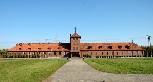
Former SS administration
building is now a Catholic Church, Oct. 2005
The road shown in the foreground of the
photo above goes past the section of the camp called Mexico,
and on to the gas chambers in Krema IV and Krema V. The new section
called Mexico was never finished; before the Nazis abandoned
the Birkenau camp in January 1945, they took down the wooden
barracks buildings in the Mexico section and moved them to the
Gross Rosen concentration camp.
 Remains of a building
in the Mexico section of Birkenau, Oct. 2005
Remains of a building
in the Mexico section of Birkenau, Oct. 2005
The photo above shows what is left of
the Mexico camp. In the foreground is the spot where a building
once stood. You can see the outlines where the barracks buildings
were located. In the background are three new houses that have
been built near the former camp. When I visited Birkenau in 1998,
the entire area of the section called Mexico was filled with
brush. In 2005 when this photo was taken, about half of the area
of Mexico had been cleared.
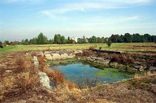
 Sewage treatment plant at Birkenau, Oct. 2005
The photo above shows the sewage treatment plant at Birkenau. On the right side are four round brick structures in which the sewage was treated at Birkenau; on the left side is a deep hole that was part of the treatment facility. This photo was taken at the west end of the camp, north of the Krema II and Krema III gas chambers.
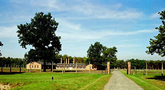 Sauna building where
the clothing was disinfected
Sauna building where
the clothing was disinfected
The photo above shows the building called
"the central sauna" where the clothing of the prisoners
was disinfected. Note the fence around this section of the Birkenau
camp and the gate posts where a gate used to be. On the right
side of the photo is the location of the clothing warehouses,
called "Canada." In the background can be seen another
gate into the section where the Krema IV and Krema V gas chambers
were located. The road shown in the photo above runs along the
western boundary of the camp and intersects the road that starts
at the SS administration building.
This page was last updated on June 2,
2009
|